
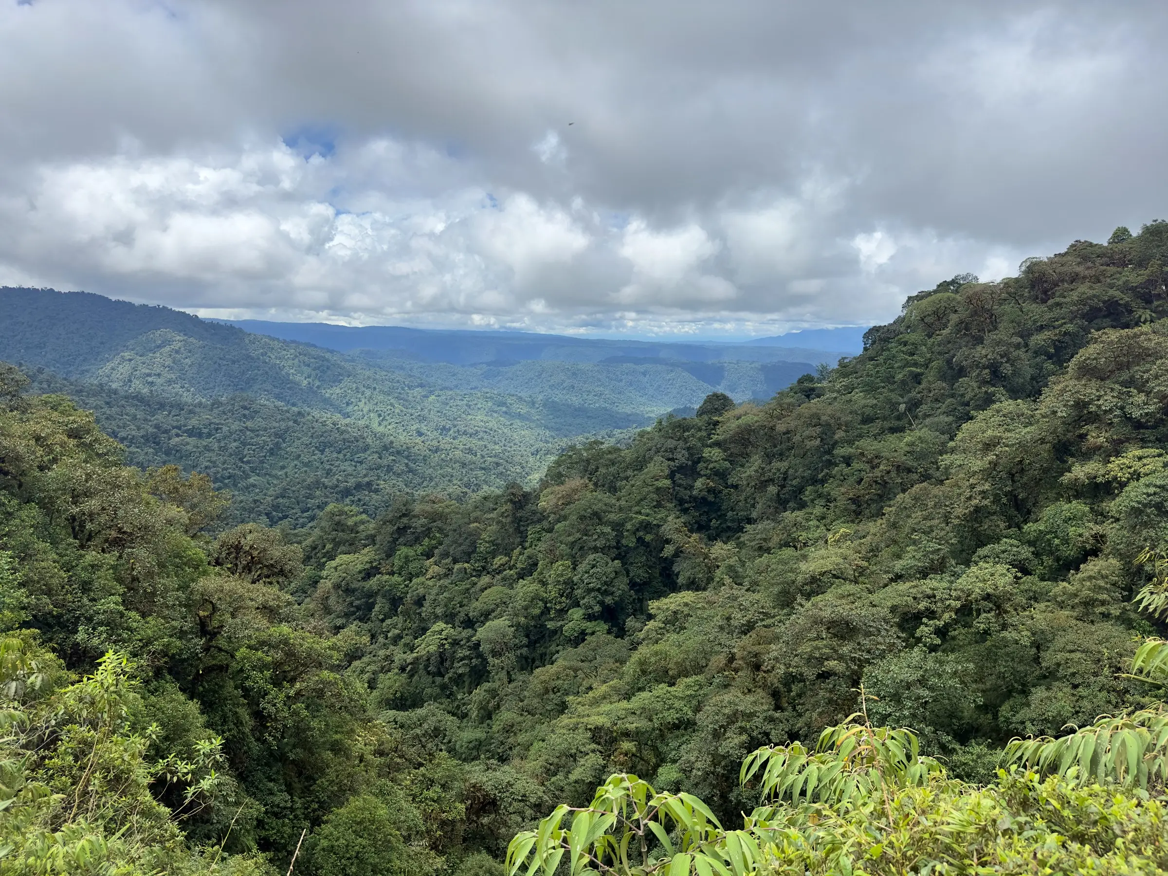
Most cloud forest Ecuador guides send you to Mindo, on the western Andes. This one covers the other side: the eastern slope that faces the Amazon. Around Cuyuja, where our farm sits at about 2,330 m, roughly 90% of the parish lies inside Cayambe-Coca National Park and Antisana Ecological Reserve.
What is a cloud forest?
A cloud forest is an evergreen mountain forest with frequent low cloud at canopy level. That is the core of the Wikipedia definition, which also calls it a tropical montane cloud forest.
It forms when wind pushes moist air up a mountain. The air cools as it rises and condenses into cloud on the slope. Water then reaches the forest in two ways: as rain, and as "fog drip" that condenses on leaves and falls to the ground.
- Where: mostly between 25°N and 25°S, from about 500 m to 4,000 m above sea level.
- Climate: mean temperatures of roughly 8–20 °C, and 500 to 10,000 mm of rain a year.
- Look: shorter, gnarled trees, dense stems and small, tough leaves.
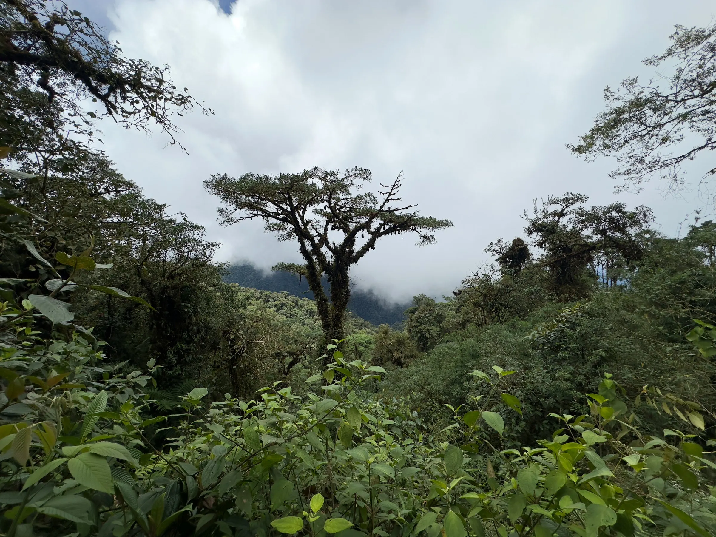
- Signature: masses of epiphytes, such as mosses, ferns, bromeliads and orchids, growing on the trees.
On some trees, the mosses and other epiphytes weigh more than the tree's own leaves. That spongy layer stores water, which is why cloud forests matter so much to the rivers below them.
Why is the eastern slope different from Mindo?
The two slopes face different lowlands, so they get their moisture from different places. Mindo, the most visited cloud forest Ecuador offers, looks west toward the Chocó; Cuyuja looks east toward the Amazon.
Scientists even map them as separate ecoregions. The eastern side belongs to the Eastern Cordillera Real montane forests, a band about 1,500 km long and sometimes only 30 km wide. Moist air from the Amazon basin feeds it. The western side is part of the Northwestern Andean montane forests.
Mindo is also far busier. Wikipedia says nearly 200,000 tourists visit the valley each year. Cuyuja is a rural parish of 504 people (2022 census), strung out along one road.
Cloud forest Ecuador: east slope vs west slope
Here is the cloud forest Ecuador has on each side of the Andes, using only published figures. The eastern column is our home; the western one is the Mindo valley.
| East slope (Cuyuja) | West slope (Mindo) | |
|---|---|---|
| Ecoregion | Eastern Cordillera Real montane forests | Northwestern Andean montane forests |
| Faces | The Amazon basin | The Chocó lowlands |
| Rivers | Napo/Coca basin: Chalpi, Blanco, Victoria, Quijos and others | Mindo, Saloya and Cinto |
| Rainfall | 1,000–1,500 mm/yr in upper Cuyuja, 3,000–3,500 mm lower down | 2,000–4,000 mm/yr for the ecoregion, less higher up |
| Altitude | San Pedrito about 2,330 m; Guango about 2,700 m | Mindo valley 960–3,440 m |
| Protected land | About 90% of Cuyuja parish (Cayambe-Coca, Antisana) | 86 km² in the Mindo-Nambillo protected forest |
| Visitors | Rural parish, 504 residents | Nearly 200,000 tourists a year |
The cloud forest of Cuyuja in numbers
Cuyuja shows how much cloud forest Ecuador still keeps in its eastern valleys. It is wet, cool and mostly wild. These figures come from the parish council and a 2022 bird study by Reyes Vargas and colleagues.
- Area: 316 km², and 90.7–91.7% of it is natural vegetation.
- Protection: about 90% of the parish lies inside Cayambe-Coca National Park and Antisana Ecological Reserve.
- Temperature: 10–16 °C in the populated zone, with humidity above 80% all year.
- Rain: fairly even all year; May to August are the wettest months.
- Water: its rivers feed two national water projects that supply drinking water to Quito.
Epiphytes and the plants named after Cuyuja
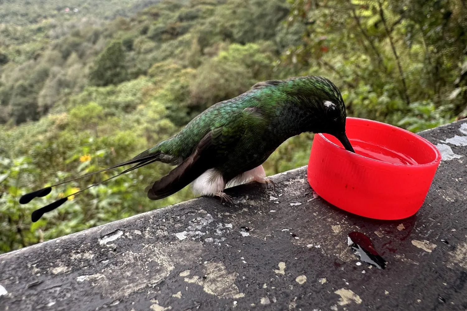
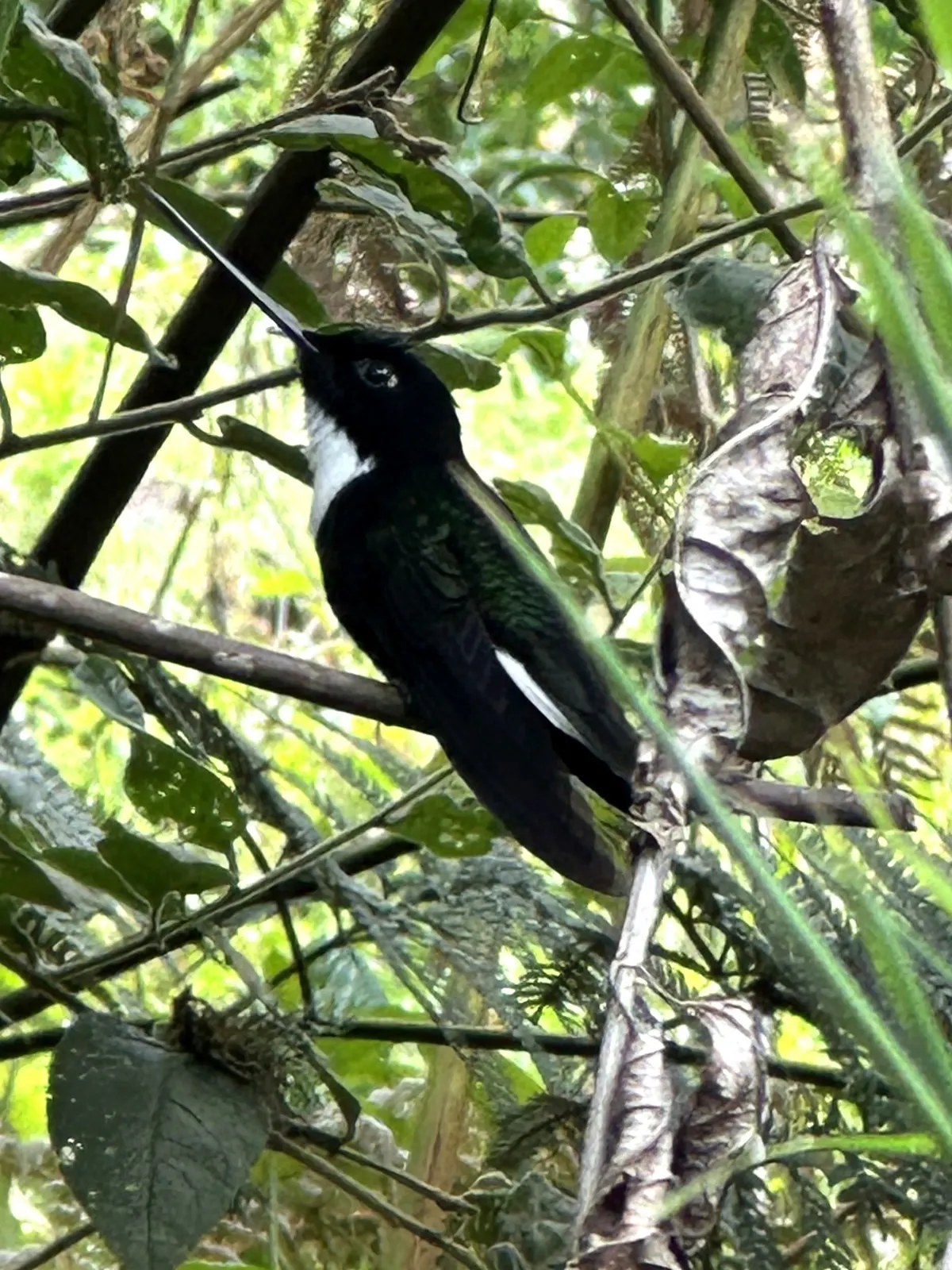
Epiphytes are the signature of every cloud forest. Ecuador's eastern slope is no exception: look up at any old tree here and you will see a garden on its branches. Bromeliads, mosses, ferns and orchids grow on the bark without harming it. The Collared Inca, the hummingbird we have photographed on our farm, favours epiphytes and especially bromeliads.
Some plants even carry the village's name. Psammisia cuyujensis is a blueberry-family shrub that grows on other plants; its type specimen was collected at 3,450 m on the Cuyuja–Quito road, according to the New York Botanical Garden. There is also an orchid, Ponthieva cuyujana, and a near-threatened frog nicknamed the "rana gorda de Cuyuja".
In our garden we plant the natives that local hummingbirds use, from tacso to fuchsias. See the hummingbird plants of the Andes list and what hummingbirds eat in this forest.
What lives in the eastern cloud forest?
A lot more than you will see in one morning in any cloud forest. Ecuador's eastern slope is especially rich: the Cuyuja study logged 141 bird species in 28 lists in 2019–2020, including 14 hummingbirds.
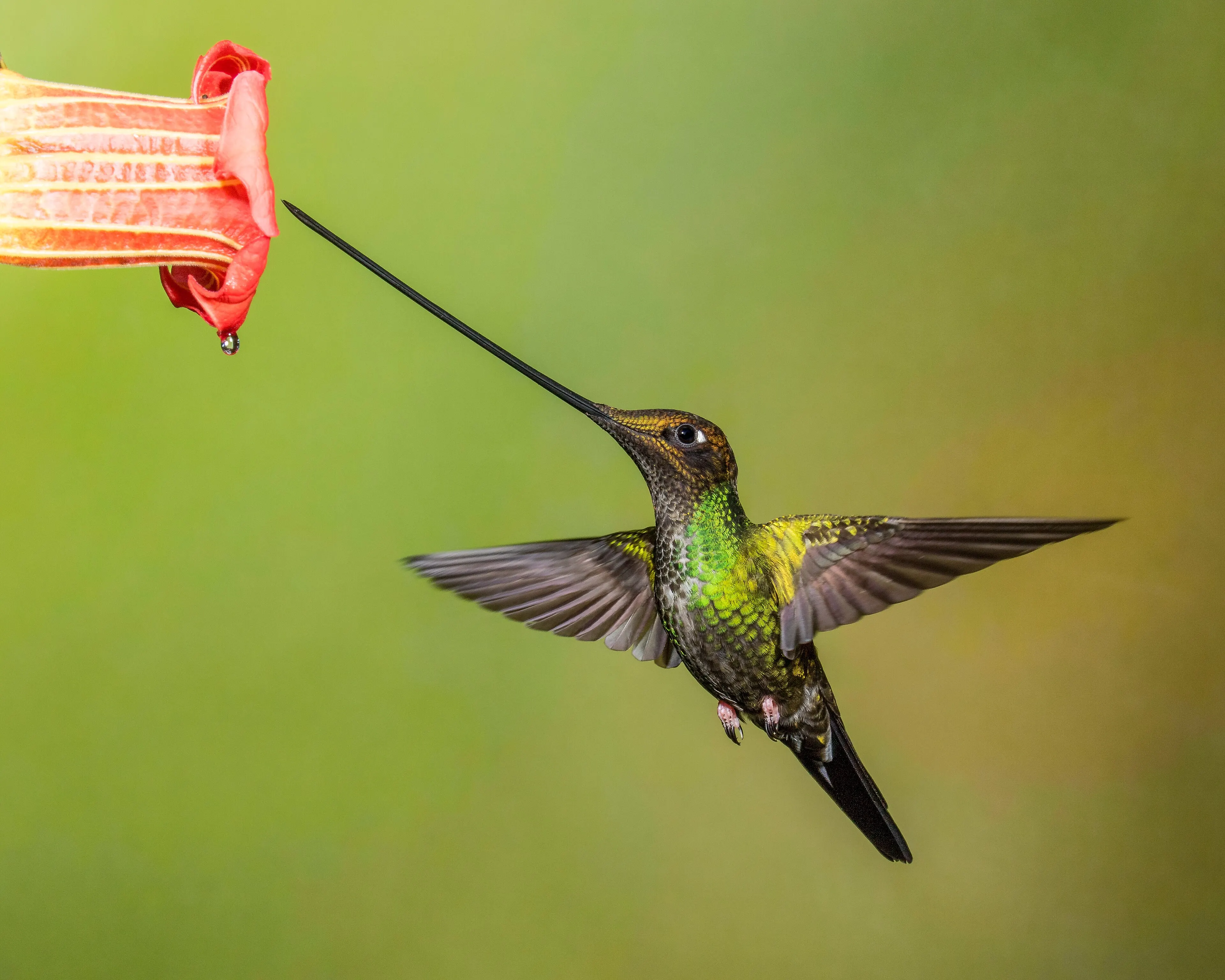
- Hummingbirds: the Sword-billed Hummingbird, Collared Inca, Long-tailed Sylph, Tourmaline Sunangel and the coronets are all recorded in the area.
- River birds: Torrent Ducks and White-capped Dippers on the fast rivers.
- Forest birds: the Blue-winged Mountain-Tanager was the most-counted tanager; the endangered Black-and-chestnut Eagle was also recorded.
- Mammals: spectacled bears are seen on the road, and mountain tapirs live in the park but are rarely seen.
The wider Cayambe-Coca National Park counts 106 mammal, 395 bird, 70 reptile and 116 amphibian species. Only one hummingbird, the Collared Inca, has been photographed on our own land so far, so we promise nothing more than that.
Is the cloud forest in danger?
Yes, slowly. Wikipedia reports that about 2.4% of the world's cloud forest cover was lost between 2001 and 2018. Warming is also expected to push cloud forest climates uphill.
Locally, the 2022 Cuyuja study notes that forest is being cleared for pasture, since dairy farming is the main living here. Every hectare cleared is cloud forest Ecuador loses, along with the water it holds. Visitors who pay to see birds in standing forest give families a reason to keep it standing.
7 tips to visit the cloud forest responsibly
Good visits are quiet ones. These simple habits protect the cloud forest Ecuador shares with its bears and birds.
- Stay on trails. Mossy slopes are fragile and slippery.
- Never collect plants. Leave orchids and bromeliads where they grow; buy nursery-grown ones.
- Keep your distance from bears on the road, never feed them, and report sightings to ECU 911.
- Go easy on flash at feeders, and never handle birds.
- Pack for rain: a waterproof jacket, warm layers and shoes with grip.
- Take your rubbish back with you, including fruit peel and bottle caps.
- Spend locally: eat, sleep and hire guides in the parishes you visit.
Want to walk in this cloud forest? Ecuador's eastern slope is a day trip from the capital: read how to get here from Quito, then our Cuyuja guide for waterfalls and other stops on the way.
Cloud forest Ecuador: FAQ
What is a cloud forest?
An evergreen mountain forest wrapped in low cloud, usually at canopy level. The constant moisture feeds thick mosses, ferns, bromeliads and orchids growing on the trees.
Where is the cloud forest in Ecuador?
On both slopes of the Andes. The best-known cloud forest Ecuador has is Mindo, on the western slope. The eastern slope, along the Papallacta–Baeza road where we live, faces the Amazon and is much less visited.
What is the difference between a cloud forest and a rainforest?
Altitude and cloud. A cloud forest grows on mountains, roughly 500 to 4,000 m, where cloud sits on the trees. Lowland rainforest is hotter and taller, with less of the moss and epiphyte load.
How cold is the cloud forest at Cuyuja?
Cool, not cold. The parish council gives 10–16 °C for the populated zone, with humidity above 80% all year. It is colder up on the Papallacta pass.
When is the best time to visit the eastern cloud forest?
Any month works for birds in this cloud forest. Ecuador's east slope gets rain all year; around Cuyuja, May to August are the wettest months and December to February bring more dry spells.
Can I see hummingbirds in the cloud forest?
Yes. A bird survey in Cuyuja recorded 14 hummingbird species. We have photographed the Collared Inca on our farm; other species are recorded in the area, not promised at our feeders.
Sources
- Wikipedia: Cloud forest (definition, climate, epiphytes, forest loss), Eastern Cordillera Real montane forests, Northwestern Andean montane forests, Mindo, Ecuador, Cayambe Coca National Park.
- GAD Parroquial de Cuyuja, Datos generales (area, climate, protected areas).
- Reyes Vargas, M.V., Salagaje Muela, L.A. & Ortega Ocaña, Á.F. (2022). Estado actual de la avifauna en Quijos Huayco, parroquia Cuyuja. Siembra 9(2): e3725. doi:10.29166/siembra.v9i2.3725
- City Population, Napo parishes (2022 census).
- NYBG, Psammisia cuyujensis; Ponthieva cuyujana.
- Teleamazonas, spectacled bear with cubs on the Baeza–Papallacta road.